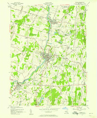
1957 Map of Walden
USGS Topo · Published 1958About this map
The Wallkill River defines the central axis of this mid-century Orange County landscape, carving through a region defined by agricultural estates and vital infrastructure. The Borden Estate and the Wallkill Valley Cemetery are prominent landmarks near the industrial center of Walden, while the Maybrook Yards to the south underscore the area's importance as a rail hub during this era. The map traces the paths of multiple rail lines, including the New York Central and Hudson River Railroad, which connected these valley settlements to broader markets.
Find a feature on this map
65 named features on this map. Tap any name to fly to it.
Don’t see what you’re looking for? This feature index may not catch every label — zoom into the map to look around manually.
Map Details
Editions of this 1957 Walden Map
2 editions found
Other maps of this area

1902 · Schunemunk
USGS Topo · 1:62,500

1903 · Newburg
USGS Topo · 1:62,500

1904 · Ellenville
USGS Topo · 1:62,500

1906 · Ellenville
USGS Topo · 1:62,500

1906 · Goshen
USGS Topo · 1:62,500

1908 · Goshen
USGS Topo · 1:62,500

1930 · Schunemunk
USGS Topo · 1:48,000

1935 · Schunemunk
USGS Topo · 1:62,500

1938 · Goshen
USGS Topo · 1:62,500

1942 · Goshen
USGS Topo · 1:24,000