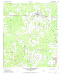
1968 Map of Waldo
USGS Topo · Published 1978About this map
Waldo serves as the central hub of this 1960s landscape, positioned along the St Louis Southwestern railroad. The surrounding Columbia County countryside is defined by a dense network of family and community landmarks, from Porter Chapel to the historic Frog Level Plantation in the Clay township. The terrain is marked by numerous watercourses including Beech Creek and Big Creek, while the southern reaches reveal the area's industrial character near Magnolia.
Find a feature on this map
51 named features on this map. Tap any name to fly to it.
Don’t see what you’re looking for? This feature index may not catch every label — zoom into the map to look around manually.
Map Details
Editions of this 1968 Waldo Map
2 editions found

Other maps of this area

1953 · El Dorado
USGS Topo · 1:250,000

1957 · El Dorado
USGS Topo · 1:250,000

1958 · El Dorado
USGS Topo · 1:250,000

1960 · El Dorado
USGS Topo · 1:250,000

1960 · Bussey
USGS Topo · 1:24,000

1960 · Macedonia
USGS Topo · 1:24,000

1966 · Calhoun
USGS Topo · 1:24,000

1968 · Buckner
USGS Topo · 1:24,000

1968 · Lamartine
USGS Topo · 1:24,000
1968 · Falcon
USGS Topo · 1:24,000