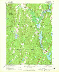
1967 Map of Wales
USGS Topo · Published 1970About this map
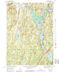
Brimfield and Holland anchor this 1960s study of the hills and headwaters along the Massachusetts-Connecticut border. The landscape is defined by its significant water management and recreational features, including the East Brimfield Reservoir and Hamilton Reservoir. In the west, the Brimfield State Forest blankets the high ground around Mount Pisgah, while the southeastern corner is preserved within the Nipmuck State Forest and Bigelow Hollow State Park. This era shows the developed network of the Mass Tpke cutting through the northeast, contrasted by the older settlement patterns of Wales and Mashapaug. Geologists and local historians will find interest in the numerous named summits like Rattlesnake Mtn and Haynes Hill, alongside smaller water bodies such as Lost Lake and Pork Barrel Pond.
Find a feature on this map
64 named features on this map. Tap any name to fly to it.
Don’t see what you’re looking for? This feature index may not catch every label — zoom into the map to look around manually.
Map Details
Editions of this 1967 Wales Map
5 editions found
Other maps of this area

1887 · Brookfield
USGS Topo · 1:62,500

1887 · Palmer
USGS Topo · 1:62,500

1889 · Palmer
USGS Topo · 1:62,500

1890 · Brookfield
USGS Topo · 1:62,500

1892 · Woodstock
USGS Topo · 1:62,500

1892 · Tolland
USGS Topo · 1:62,500

1893 · Palmer
USGS Topo · 1:62,500

1893 · Brookfield
USGS Topo · 1:62,500

1908 · Ware
USGS Topo · 1:125,000

1915 · Brookfield
USGS Topo · 1:62,500