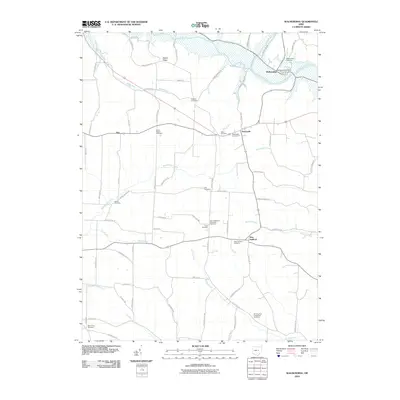
2010 Map of Walhonding
USGS Topo · Published 2010About this map
The Walhonding River serves as a focal point for this area, where it is formed by the confluence of the Kokosing River and the Mohican River near the settlement of Walhonding. The landscape is defined by its watercourses and the high ground of Rabbit Ridge, which overlooks a rural network of townships and small communities. For genealogists, the map is particularly valuable for its documentation of numerous burial sites, including the Butler Baptist Cemetery near Esto and the Saint Matthews Episcopal Cemetery. Local infrastructure is anchored by the Walhonding Post Office and the centralized crossing at Newcastle, while the surrounding terrain is marked by smaller creeks like Wakatomika Creek and Winding Fork. Agriculture remains prominent through landmarks like Farmers Orchards, indicating the continued rural character of this part of Coshocton County.
Find a feature on this map
78 named features on this map. Tap any name to fly to it.
Don’t see what you’re looking for? This feature index may not catch every label — zoom into the map to look around manually.
Map Details
Editions of this 2010 Walhonding Map
This is the sole edition of this map. No revisions or reprints were ever made.
Other maps of this area

1909 · Newark
USGS Topo · 1:62,500

1910 · Frazeysburg
USGS Topo · 1:62,500

1912 · Gambier
USGS Topo · 1:62,500

1913 · Brinkhaven
USGS Topo · 1:62,500

1914 · Gambier
USGS Topo · 1:62,500

1915 · Brinkhaven
USGS Topo · 1:62,500

1943 · Gambier
USGS Topo · 1:62,500

1950 · Marion
USGS Topo · 1:250,000
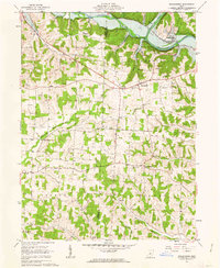
1961 · Walhonding
USGS Topo · 1:24,000
1961 · Hickman
USGS Topo · 1:24,000