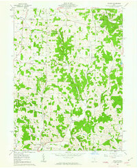
1961 Map of Hickman
USGS Topo · Published 1963About this map
The Knox and Licking County line cuts across a landscape defined by an active resource economy during the early 1960s. Extensive oil and gas fields and numerous gas and oil wells dot the terrain, particularly near Jackson and Maryann townships. Small rural centers like Hickman and Purity serve as local anchors alongside historical landmarks such as a Covered Bridge over Rocky Fork.
Find a feature on this map
44 named features on this map. Tap any name to fly to it.
Don’t see what you’re looking for? This feature index may not catch every label — zoom into the map to look around manually.
Map Details
Editions of this 1961 Hickman Map
4 editions found
Other maps of this area

1909 · Newark
USGS Topo · 1:62,500

1910 · Frazeysburg
USGS Topo · 1:62,500

1912 · Gambier
USGS Topo · 1:62,500

1913 · Brinkhaven
USGS Topo · 1:62,500

1914 · Gambier
USGS Topo · 1:62,500

1915 · Brinkhaven
USGS Topo · 1:62,500

1943 · Gambier
USGS Topo · 1:62,500

1950 · Marion
USGS Topo · 1:250,000

1961 · Hanover
USGS Topo · 1:24,000

1961 · Newark
USGS Topo · 1:24,000