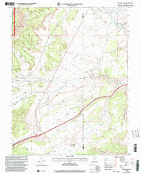
2001 Map of Walker Flat
USGS Topo · Published 2003About this map
Walker Flat dominates this high-altitude landscape along the border of Sevier and Emery counties, where the western edge of the plateau transitions into the protected timber of the Fishlake National Forest. The 2001 revision highlights a complex drainage system defined by Quitchupah Creek and Ivie Creek, which carve deep channels through the prominent Benches and Saleratus formations. Evidence of the region's extraction history is centered around the Dog Valley Mine and Browning Mine, alongside several unidentified mine and prospect workings. These operations were strategically situated near water sources like Dog Valley Wash and Spring Creek, reflecting the essential relationship between local topography and the area's mining economy at the opening of the twenty-first century.
Find a feature on this map
23 named features on this map. Tap any name to fly to it.
Don’t see what you’re looking for? This feature index may not catch every label — zoom into the map to look around manually.
Map Details
Editions of this 2001 Walker Flat Map
This is the sole edition of this map. No revisions or reprints were ever made.
Other maps of this area

1885 · Fish Lake
USGS Topo · 1:250,000

1896 · Fish Lake
USGS Topo · 1:250,000

1922 · Emery No.3
USGS Topo · 1:31,680

1925 · Acord Lakes
USGS Topo · 1:62,500

1956 · Salina
USGS Topo · 1:250,000

1960 · Salina
USGS Topo · 1:250,000

1962 · Salina
USGS Topo · 1:250,000

1968 · Johns Peak
USGS Topo · 1:24,000
1968 · Old Woman Plateau
USGS Topo · 1:24,000
1968 · Walker Flat
USGS Topo · 1:24,000