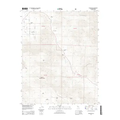
2015 Map of Walker Pass
USGS Topo · Published 2015About this map
Walker Pass serves as a critical point of elevation in the southern Sierra Nevada, marking a historical transition between the Mojave Desert and the high mountain terrain. This 2015 survey details the rugged topography within the Sequoia National Forest, where the Pacific Crest National Scenic Trail winds through the landscape, crossing from Freeman Canyon into the high country. The drainage of Canebrake Cr defines much of the central valley floor, leading toward the residential roads of Canebrake Flat. To the south, the Scodie Mountains rise sharply above Smith Canyon and Cow Heaven Canyon, illustrating the complex geological folds of the region. Local landmarks like Pinyon Peak and Coyote Spring highlight the sparse but vital water and lookout points that have guided travelers through these Kern County mountains for generations.
Find a feature on this map
30 named features on this map. Tap any name to fly to it.
Don’t see what you’re looking for? This feature index may not catch every label — zoom into the map to look around manually.
Map Details
Editions of this 2015 Walker Pass Map
This is the sole edition of this map. No revisions or reprints were ever made.
Other maps of this area

1906 · Kernville
USGS Topo · 1:125,000

1908 · Kernville
USGS Topo · 1:125,000

1915 · Searles Lake
USGS Topo · 1:250,000

1943 · Inyokern
USGS Topo · 1:62,500

1943 · Onyx
USGS Topo · 1:62,500

1947 · Trona
USGS Topo · 1:250,000

1948 · Trona
USGS Topo · 1:250,000

1948 · Bakersfield
USGS Topo · 1:250,000

1953 · Trona
USGS Topo · 1:250,000

1954 · Little Lake
USGS Topo · 1:62,500