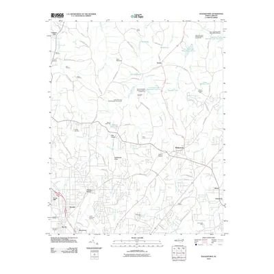
2010 Map of Walkertown
USGS Topo · Published 2010About this map
Walkertown and its surrounding residential developments anchor this Forsyth County landscape, reflecting the suburban expansion northeast of Winston-Salem in the first decade of the 21st century. The map provides significant genealogical value through its detailed labeling of numerous burial grounds, including the Garden of Memories Cemetery, Banner Cemetery, Mecum Cemetery, and the Odd Fellows Cemetery near the southern boundary. To the west, the presence of the Smith Reynolds Airport and Ogburn Station indicates the area's integration into the regional transport and aviation networks.
Find a feature on this map
101 named features on this map. Tap any name to fly to it.
Don’t see what you’re looking for? This feature index may not catch every label — zoom into the map to look around manually.
Map Details
Editions of this 2010 Walkertown Map
This is the sole edition of this map. No revisions or reprints were ever made.
Other maps of this area

1950 · Winston-Salem West
USGS Topo · 1:24,000

1950 · Winston-Salem East
USGS Topo · 1:24,000

1951 · Winston-Salem West
USGS Topo · 1:24,000

1951 · Winston-Salem East
USGS Topo · 1:24,000

1951 · Rural Hall
USGS Topo · 1:24,000

1951 · Walkertown
USGS Topo · 1:24,000

1953 · Winston-Salem
USGS Topo · 1:250,000

1955 · Winston-Salem
USGS Topo · 1:250,000

1962 · Winston-Salem
USGS Topo · 1:250,000

1964 · King
USGS Topo · 1:24,000