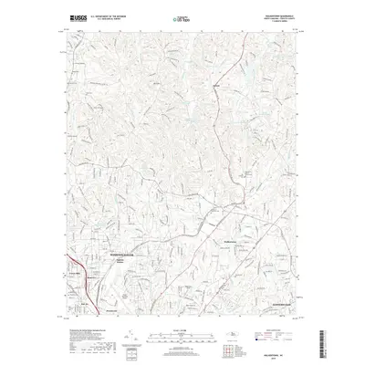
2019 Map of Walkertown
USGS Topo · Published 2019About this map
The northern reaches of Winston-Salem and the community of Walkertown anchor this 2019 survey, where suburban development meets the prominent elevations of Baux Mountain. The landscape is a mix of aviation and education infrastructure, notably featuring the Smith Reynolds Airport and the Memorial Industrial School grounds. Transportation history is etched across the terrain through the Norfolk Southern rail line and the localized hub at Ogburn Station.
Find a feature on this map
261 named features on this map. Tap any name to fly to it.
Don’t see what you’re looking for? This feature index may not catch every label — zoom into the map to look around manually.
Map Details
Editions of this 2019 Walkertown Map
This is the sole edition of this map. No revisions or reprints were ever made.
Other maps of this area

1950 · Winston-Salem West
USGS Topo · 1:24,000

1950 · Winston-Salem East
USGS Topo · 1:24,000

1951 · Winston-Salem West
USGS Topo · 1:24,000

1951 · Winston-Salem East
USGS Topo · 1:24,000

1951 · Rural Hall
USGS Topo · 1:24,000

1951 · Walkertown
USGS Topo · 1:24,000

1953 · Winston-Salem
USGS Topo · 1:250,000

1955 · Winston-Salem
USGS Topo · 1:250,000

1962 · Winston-Salem
USGS Topo · 1:250,000

1964 · King
USGS Topo · 1:24,000