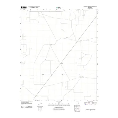
2010 Map of Walking Cane Ranch
USGS Topo · Published 2010About this map
Louis Walking Cane Ranch serves as the primary named settlement feature in this portion of Lea County, illustrating the isolated ranching life typical of the High Plains. The landscape is defined by a systematic grid of county roads, including County Rd-181 and County Rd-174, which connect far-flung resource points. Essential water infrastructure is clearly marked through a network of named landmarks such as Antelope Windmill, Lambert Windmill, and Northwest Windmill. These features indicate a terrain where groundwater access dictates the viability of the cattle industry. The presence of several other strategically placed wells, like Southwest Windmill and New Windmill, highlights the critical role of these localized water sources in maintaining the vast ranching operations of southeastern New Mexico.
Find a feature on this map
12 named features on this map. Tap any name to fly to it.
Don’t see what you’re looking for? This feature index may not catch every label — zoom into the map to look around manually.
Map Details
Editions of this 2010 Walking Cane Ranch Map
This is the sole edition of this map. No revisions or reprints were ever made.
Other maps of this area

1954 · Brownfield
USGS Topo · 1:250,000

1958 · Brownfield
USGS Topo · 1:250,000

1962 · Brownfield
USGS Topo · 1:250,000

1970 · Bronco NE
USGS Topo · 1:24,000

1970 · Walking Cane Ranch
USGS Topo · 1:24,000

1970 · Gladiola
USGS Topo · 1:24,000

1970 · Ranger Lake
USGS Topo · 1:24,000

1970 · Bronco
USGS Topo · 1:24,000

1970 · Tatum North
USGS Topo · 1:24,000

1970 · Bledsoe
USGS Topo · 1:24,000