
1970 Map of Bronco NE
USGS Topo · Published 1972About this map
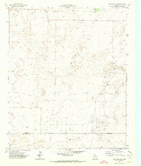
Oil and gas infrastructure dominates this 1970 landscape along the high plains border of New Mexico and Texas. The extensive Buckshot Oil Field spans the northeastern corner, characterized by a dense network of drill holes, a Pumping Sta, and a long pipeline cutting across the terrain. This industrial development exists alongside established ranching operations, such as Standefer Ranch and Gilliam Ranch. Water management is critical in this arid environment, evidenced by dozens of named wells and windmills, including South House Windmill, the Prairie Chicken Windmill, and West Goat Windmill. An aqueduct runs through the eastern sections, further illustrating the complex resource extraction and water distribution systems in place at the start of the 1970s. The tri-county boundary where Lea, Cochran, and Yoakum counties meet provides a specific point of reference for local historians.
Find a feature on this map
34 named features on this map. Tap any name to fly to it.
Don’t see what you’re looking for? This feature index may not catch every label — zoom into the map to look around manually.
Map Details
Editions of this 1970 Bronco NE Map
This is the sole edition of this map. No revisions or reprints were ever made.
Other maps of this area

1954 · Brownfield
USGS Topo · 1:250,000

1958 · Brownfield
USGS Topo · 1:250,000

1962 · Brownfield
USGS Topo · 1:250,000

1970 · Walking Cane Ranch
USGS Topo · 1:24,000

1970 · Gladiola
USGS Topo · 1:24,000

1970 · Bronco
USGS Topo · 1:24,000

1970 · Bledsoe
USGS Topo · 1:24,000

1970 · Morton SW
USGS Topo · 1:24,000
1971 · Two B Ranch NW
USGS Topo · 1:24,000
1971 · Two B Ranch SW
USGS Topo · 1:24,000