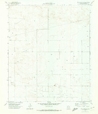
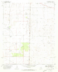
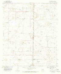
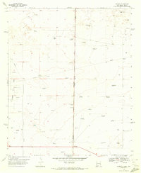
1971 Map of Two B Ranch SW
USGS Topo · Published 1974About this map
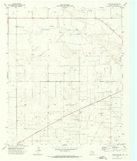
The Sable Oil Field dominates this corner of Yoakum County, revealing a landscape defined by industrial development in the early 1970s. This survey, conducted using 1970 aerial photography, documents a network of extraction and transit infrastructure, including a prominent Pipeline and numerous individual wells and oil wells scattered across the plains. The distribution of these resources suggests a period of intensive energy production, supported by localized operations like multiple Gravel Pits and a Water Tank. While the terrain remains largely open, the density of labels for Wells and extraction sites indicates how much the subsurface economy shaped the surface geography of this region during the post-war era.
Find a feature on this map
7 named features on this map. Tap any name to fly to it.
Don’t see what you’re looking for? This feature index may not catch every label — zoom into the map to look around manually.
Map Details
Editions of this 1971 Two B Ranch SW Map
This is the sole edition of this map. No revisions or reprints were ever made.
Other maps of this area

1954 · Brownfield
USGS Topo · 1:250,000

1958 · Brownfield
USGS Topo · 1:250,000

1962 · Brownfield
USGS Topo · 1:250,000
1970 · Prairieview NE
USGS Topo · 1:24,000
1970 · Bronco NE
USGS Topo · 1:24,000
1970 · Bronco
USGS Topo · 1:24,000
1971 · Plains NW
USGS Topo · 1:24,000
1971 · Schooler Ranch
USGS Topo · 1:24,000
1971 · Plains
USGS Topo · 1:24,000
1971 · Two B Ranch
USGS Topo · 1:24,000