
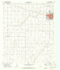
1970 Map of Morton SW
USGS Topo · Published 1973About this map
The High Plains landscape of Cochran County is defined here by the extensive industrial footprints of the Buckshot Oil Field and the Levelland and Slaughter Oil and Gas Field. These energy developments are etched across the terrain alongside the natural path of Sulphur Draw, which meanders through the central portion of the map. The spatial arrangement reveals a late-century intersection of ranching traditions and petroleum extraction, centered on the Masten Ranch near the center of the sheet.
Find a feature on this map
10 named features on this map. Tap any name to fly to it.
Don’t see what you’re looking for? This feature index may not catch every label — zoom into the map to look around manually.
Map Details
Editions of this 1970 Morton SW Map
This is the sole edition of this map. No revisions or reprints were ever made.
Other maps of this area

1954 · Brownfield
USGS Topo · 1:250,000

1958 · Brownfield
USGS Topo · 1:250,000

1962 · Brownfield
USGS Topo · 1:250,000

1969 · Lehman
USGS Topo · 1:24,000

1970 · Bronco NE
USGS Topo · 1:24,000

1970 · Bledsoe
USGS Topo · 1:24,000

1970 · Morton NW
USGS Topo · 1:24,000

1970 · Bledsoe NE
USGS Topo · 1:24,000

1971 · Schooler Ranch
USGS Topo · 1:24,000
1971 · Morton
USGS Topo · 1:24,000