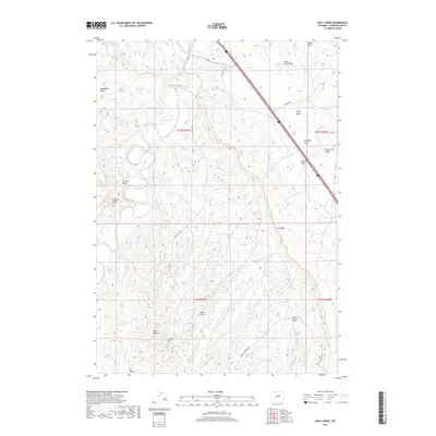
2017 Map of Wall Creek
USGS Topo · Published 2017About this map
Tisdale Mtn and the prominent escarpment known as The Wall define the high-desert character of this Johnson County landscape. The drainages of the S Fork Powder River and Wall Cr carve through a terrain marked by deep draws and canyons, including Trail Canyon and Oil Canyon. Settled ranching history and local topography are preserved in names like Linstead Flats and the striking Frewens Castle formation. Human activity is concentrated along established corridors like Wall Creek Rd and Tisdale Mountain Rd, which provide access to the area's grazing lands and water sources like the Applegate Reservoir. The network of draws, such as Terry Draw and Ellison Draw, reveals the intricate natural drainage system essential to life in this arid region of Wyoming.
Find a feature on this map
28 named features on this map. Tap any name to fly to it.
Don’t see what you’re looking for? This feature index may not catch every label — zoom into the map to look around manually.
Map Details
Editions of this 2017 Wall Creek Map
This is the sole edition of this map. No revisions or reprints were ever made.
Other maps of this area

1955 · Arminto
USGS Topo · 1:250,000

1958 · Arminto
USGS Topo · 1:250,000

1961 · Kaycee NE
USGS Topo · 1:24,000

1961 · Figure 8 Reservoir
USGS Topo · 1:24,000

1961 · TTT Ranch
USGS Topo · 1:24,000

1961 · Dugout Ranch
USGS Topo · 1:24,000

1961 · Wall Creek
USGS Topo · 1:24,000

1961 · Kaycee
USGS Topo · 1:24,000

1962 · Arminto
USGS Topo · 1:250,000

1968 · Salt Canyon
USGS Topo · 1:24,000