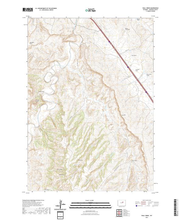
2021 Map of Wall Creek
USGS Topo · Published 2021About this map
The S Fork Powder River cuts through this high-plains landscape in Johnson County, defined by a complex network of draws and named ridges. Prominent geological features like The Wall and the dramatic Frewens Castle tower over the surrounding terrain, while Tisdale Mtn anchors the southern portion of the quadrangle. The naming of Frewens Draw and Frewens Castle hints at the ranching history of the area, specifically the late 19th-century operations of the Frewen brothers.
Find a feature on this map
25 named features on this map. Tap any name to fly to it.
Don’t see what you’re looking for? This feature index may not catch every label — zoom into the map to look around manually.
Map Details
Editions of this 2021 Wall Creek Map
This is the sole edition of this map. No revisions or reprints were ever made.
Other maps of this area

1955 · Arminto
USGS Topo · 1:250,000

1958 · Arminto
USGS Topo · 1:250,000

1961 · Kaycee NE
USGS Topo · 1:24,000

1961 · Figure 8 Reservoir
USGS Topo · 1:24,000

1961 · TTT Ranch
USGS Topo · 1:24,000

1961 · Dugout Ranch
USGS Topo · 1:24,000

1961 · Wall Creek
USGS Topo · 1:24,000

1961 · Kaycee
USGS Topo · 1:24,000

1962 · Arminto
USGS Topo · 1:250,000

1968 · Salt Canyon
USGS Topo · 1:24,000