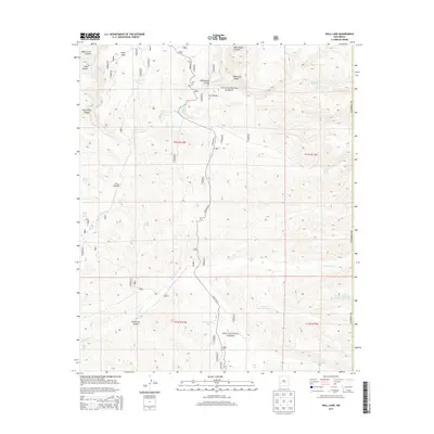
2013 Map of Wall Lake
USGS Topo · Published 2013About this map
Wall Lake sits at the heart of this high-country landscape, where Taylor Cr and Hoyt Cr converge within the Gila National Forest. The map documents a complex drainage system defining the Mogollon Plateau, characterized by deep incisions like Whitewater Canyon and North Star Canyon. This 2013 survey illustrates the critical role of water management in this arid environment, marked by a high density of named stock tanks such as Undertaker Tank, Pot Hole Tank, and Middle Diamond Tank. The remote nature of the terrain is underscored by the singular presence of State Rte 61, which snakes through the canyon floors. Significant landmarks like Kemp Mesa and the headwaters of the East Fork Gila River provide clear geographic orientation for those studying the hydrology and land use of Catron County.
Find a feature on this map
36 named features on this map. Tap any name to fly to it.
Don’t see what you’re looking for? This feature index may not catch every label — zoom into the map to look around manually.
Map Details
Editions of this 2013 Wall Lake Map
This is the sole edition of this map. No revisions or reprints were ever made.
Other maps of this area

1911 · Alum Mountain
USGS Topo · 1:125,000

1913 · Alum Mountain
USGS Topo · 1:125,000

1949 · Lookout Mountain
USGS Topo · 1:62,500

1954 · Tularosa
USGS Topo · 1:250,000

1954 · Clifton
USGS Topo · 1:250,000

1957 · Clifton
USGS Topo · 1:250,000

1958 · Clifton
USGS Topo · 1:250,000

1958 · Tularosa
USGS Topo · 1:250,000

1962 · Clifton
USGS Topo · 1:250,000

1963 · Bonner Canyon
USGS Topo · 1:24,000