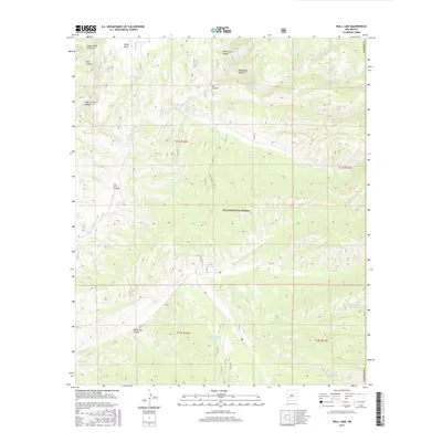
2017 Map of Wall Lake
USGS Topo · Published 2017About this map
Wall Lake and the surrounding wilderness of the Gila National Forest define this high-altitude landscape in New Mexico. The geography is characterized by a complex network of deep drainage systems, including Taylor Cr, Beaver Cr, and the E Fork Gila River. These water sources are complemented by numerous named stock tanks and springs, such as Undertaker Tank, Horse Trap Spring, and Pot Hole Tank, which provide critical water points for wildlife and livestock in this arid terrain.
Find a feature on this map
36 named features on this map. Tap any name to fly to it.
Don’t see what you’re looking for? This feature index may not catch every label — zoom into the map to look around manually.
Map Details
Editions of this 2017 Wall Lake Map
This is the sole edition of this map. No revisions or reprints were ever made.
Other maps of this area

1911 · Alum Mountain
USGS Topo · 1:125,000

1913 · Alum Mountain
USGS Topo · 1:125,000

1949 · Lookout Mountain
USGS Topo · 1:62,500

1954 · Tularosa
USGS Topo · 1:250,000

1954 · Clifton
USGS Topo · 1:250,000

1957 · Clifton
USGS Topo · 1:250,000

1958 · Clifton
USGS Topo · 1:250,000

1958 · Tularosa
USGS Topo · 1:250,000

1962 · Clifton
USGS Topo · 1:250,000

1963 · Bonner Canyon
USGS Topo · 1:24,000