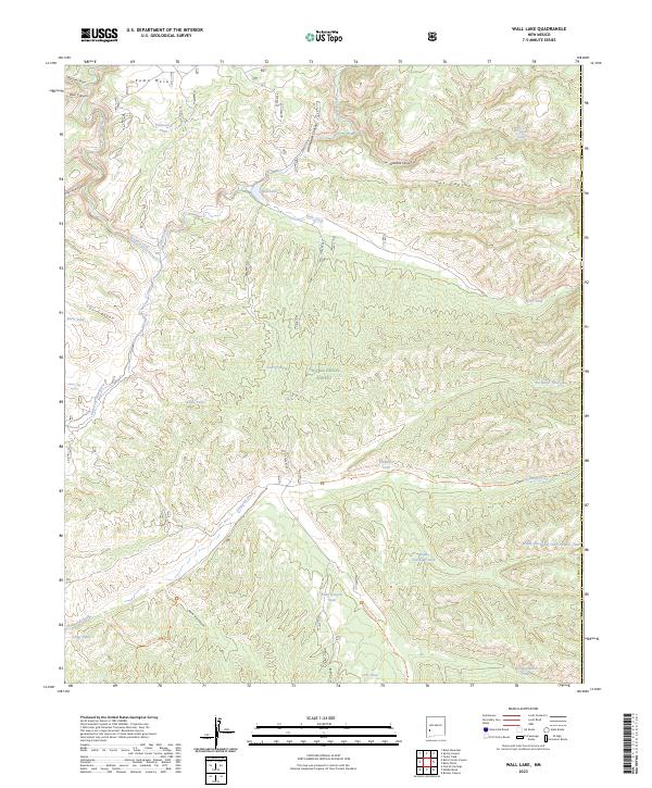
2023 Map of Wall Lake
USGS Topo · Published 2023About this map
Wall Lake and the surrounding drainages of the Gila National Forest define this high-country landscape at the junction of several major protected areas. The map details a complex network of canyons and mesas where the Gila Wilderness meets the Aldo Leopold Wilderness, separated by the flow of the East Fork Gila River. The presence of numerous named water catchments, such as Undertaker Tank and Middle Diamond Tank Number Two, speaks to the critical role of water management in this arid southwestern terrain. Modern infrastructure is limited to State Rte 61, which snakes through the center of the sheet along the Taylor Creek corridor. Local geography is further marked by significant trails and landforms, including the Diamond Creek Trl and the prominent Kemp Mesa, providing a look at the land use and accessibility in Catron County.
Find a feature on this map
39 named features on this map. Tap any name to fly to it.
Don’t see what you’re looking for? This feature index may not catch every label — zoom into the map to look around manually.
Map Details
Editions of this 2023 Wall Lake Map
This is the sole edition of this map. No revisions or reprints were ever made.
Other maps of this area

1911 · Alum Mountain
USGS Topo · 1:125,000

1913 · Alum Mountain
USGS Topo · 1:125,000

1949 · Lookout Mountain
USGS Topo · 1:62,500

1954 · Tularosa
USGS Topo · 1:250,000

1954 · Clifton
USGS Topo · 1:250,000

1957 · Clifton
USGS Topo · 1:250,000

1958 · Clifton
USGS Topo · 1:250,000

1958 · Tularosa
USGS Topo · 1:250,000

1962 · Clifton
USGS Topo · 1:250,000

1963 · Bonner Canyon
USGS Topo · 1:24,000