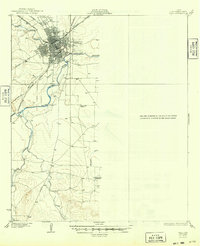
1928 Map of Wall
USGS Topo · Published 1949About this map
San Angelo stands as the primary hub of this West Texas landscape during the mid-1920s, situated at the confluence where the North Concho River joins the main Concho River. The city’s growing importance as a rail center is evident by the convergence of the Gulf Colorado and Santa Fe and the K C M and O lines. Beyond the city limits, the terrain transitions into a ranching and agricultural expanse defined by a network of drainage systems like Pecan Creek and Ninemile Creek.
Find a feature on this map
20 named features on this map. Tap any name to fly to it.
Don’t see what you’re looking for? This feature index may not catch every label — zoom into the map to look around manually.
Map Details
Editions of this 1928 Wall Map
2 editions found
Other maps of this area

1891 · Hayrick
USGS Topo · 1:125,000

1892 · San Angelo
USGS Topo · 1:125,000

1894 · Hayrick
USGS Topo · 1:125,000

1895 · Sherwood
USGS Topo · 1:125,000

1924 · San Angelo 2-c
USGS Topo · 1:48,000

1924 · Sherwood 1-d
USGS Topo · 1:48,000

1924 · San Angelo 2-b
USGS Topo · 1:48,000

1924 · Sherwood 1-a
USGS Topo · 1:48,000

1928 · Wall
USGS Topo · 1:62,500

1928 · Tankersly
USGS Topo · 1:62,500