
1953 Map of Walla Walla
USGS Topo · Published 1964About this map
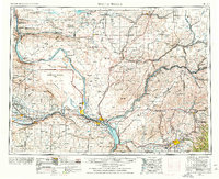
Walla Walla and the burgeoning Tri-Cities area anchor this mid-century look at the Columbia Basin during a period of massive hydraulic and industrial expansion. The presence of the Hanford Works (AEC) along the Columbia River highlights the region's critical role in the atomic age, while the rise of the Ice Harbor Dam and Priest Rapids Dam signals the transformation of the river systems for power and irrigation.
Find a feature on this map
243 named features on this map. Tap any name to fly to it.
Don’t see what you’re looking for? This feature index may not catch every label — zoom into the map to look around manually.
Map Details
Editions of this 1953 Walla Walla Map
3 editions found
Other maps of this area

1906 · Blalock Island
USGS Topo · 1:125,000

1908 · Blalock Island
USGS Topo · 1:125,000

1908 · Umatilla
USGS Topo · 1:125,000

1909 · Quincy
USGS Topo · 1:62,500

1910 · Zillah
USGS Topo · 1:125,000

1910 · Quincy
USGS Topo · 1:62,500

1910 · Winchester
USGS Topo · 1:62,500

1911 · Red Rock
USGS Topo · 1:62,500

1912 · Moses Lake
USGS Topo · 1:62,500

1912 · Beverly
USGS Topo · 1:62,500