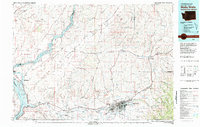
1980 Map of Walla Walla
USGS Topo · Published 1980About this map
Walla Walla and its surrounding agricultural valley anchor this 1980 survey, illustrating a landscape defined by the convergence of the Walla Walla River and the Snake River. The region’s deep historical roots are evidenced by the Whitman Mission Nat Historical Site and the presence of the State Penitentiary north of the city center. Transportation patterns are dominated by the Burlington Northern and Union Pacific railroads, which service the scattered farming settlements like Lowden, Touchet, and Waitsburg. To the west, the massive scale of the Ice Harbor Dam and the Lake Wallula reservoir contrast with the natural expanses of Eureka Flat and the Skyrocket Hills. The map also captures the residential growth of College Place and the industrial activity near Burbank, providing a clear view of the region's mid-century infrastructure and land use.
Find a feature on this map
111 named features on this map. Tap any name to fly to it.
Don’t see what you’re looking for? This feature index may not catch every label — zoom into the map to look around manually.
Map Details
Editions of this 1980 Walla Walla Map
2 editions found
Other maps of this area

1908 · Umatilla
USGS Topo · 1:125,000

1915 · Wallulah
USGS Topo · 1:96,000

1916 · Connell
USGS Topo · 1:125,000

1917 · Pasco
USGS Topo · 1:125,000

1918 · Connell
USGS Topo · 1:125,000

1918 · Wallula
USGS Topo · 1:125,000

1919 · Walla Walla
USGS Topo · 1:125,000

1921 · Walla Walla
USGS Topo · 1:125,000

1925 · Scooteney Lake
USGS Topo · 1:62,500

1935 · Pendleton
USGS Topo · 1:125,000