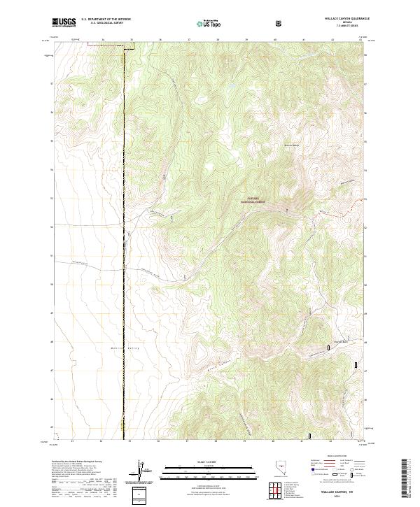
2021 Map of Wallace Canyon
USGS Topo · Published 2021About this map
Toiyabe National Forest dominates the central high ground of this Nevada landscape, where the Monitor Range transitions westward into the broad Monitor Valley. This high-desert terrain is marked by essential water sources like Laxaque Spring and Reynolds Cr, which supported the livestock and transit needs of the era. The land is heavily dissected by drainage systems, including the prominent Wallace Canyon and the branching Brock Canyon, with its designated South Fork Brock Canyon and Lower Brock Canyon. A network of Forest Service and local roads, such as the North Wallace - Allison route and the North Woods Spur, provides access through the rugged basins. The map also delineates the jurisdictional boundary between Lander Co and Eureka Co, a critical detail for researchers tracing land records or grazing rights in this part of the Great Basin.
Find a feature on this map
26 named features on this map. Tap any name to fly to it.
Don’t see what you’re looking for? This feature index may not catch every label — zoom into the map to look around manually.
Map Details
Editions of this 2021 Wallace Canyon Map
This is the sole edition of this map. No revisions or reprints were ever made.
Other maps of this area

1926 · Roberts Mountains
USGS Topo · 1:250,000

1929 · Roberts Mountains
USGS Topo · 1:250,000

1955 · Millett
USGS Topo · 1:250,000

1956 · Horse Heaven Mtn
USGS Topo · 1:62,500

1956 · Antelope Peak
USGS Topo · 1:62,500

1959 · Millett
USGS Topo · 1:250,000

1960 · Hickison Summit
USGS Topo · 1:62,500

1960 · Dianas Punch Bowl
USGS Topo · 1:62,500

1978 · Summit Mountain
USGS Topo · 1:100,000
1989 · White Sage Canyon
USGS Topo · 1:24,000