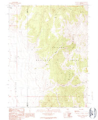
1989 Map of Wallace Canyon
USGS Topo · Published 1990About this map
The Toiyabe Range and the Monitor Range converge in this high-altitude landscape along the border of Lander and Eureka counties. Established within the Toiyabe National Forest, the terrain is defined by steep drainage systems like Wallace Canyon and Brock Canyon that feed into the expansive Monitor Valley to the west. Evidence of water management and early ranching or travel routes appears in the form of named water sources such as Laxague Spring, Waldos Well, and Reynolds Creek. The inclusion of Battle Summit and the Charnac Basin provides valuable spatial context for researchers tracing historical movement through these central Nevada mountain corridors. This provisional survey captures the intersection of natural topography and remote landmarks before late-twentieth-century developments altered the character of the high desert basin and range province.
Find a feature on this map
14 named features on this map. Tap any name to fly to it.
Don’t see what you’re looking for? This feature index may not catch every label — zoom into the map to look around manually.
Map Details
Editions of this 1989 Wallace Canyon Map
This is the sole edition of this map. No revisions or reprints were ever made.
Other maps of this area

1926 · Roberts Mountains
USGS Topo · 1:250,000

1929 · Roberts Mountains
USGS Topo · 1:250,000

1955 · Millett
USGS Topo · 1:250,000

1956 · Horse Heaven Mtn
USGS Topo · 1:62,500

1956 · Antelope Peak
USGS Topo · 1:62,500

1959 · Millett
USGS Topo · 1:250,000

1960 · Hickison Summit
USGS Topo · 1:62,500

1960 · Dianas Punch Bowl
USGS Topo · 1:62,500

1978 · Summit Mountain
USGS Topo · 1:100,000
1989 · White Sage Canyon
USGS Topo · 1:24,000