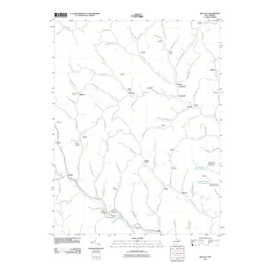
2011 Map of Wallace
USGS Topo · Published 2011About this map
Wallace and its surrounding hill country in the northern West Virginia coalfields are defined by a network of creeks and small settlements in the early 21st century. The landscape is punctuated by numerous family and community burial grounds, from the Independent Order of Oddfellows Cemetery near Brown to the Scritchfield Cemetery and Hildreth Cemetery further north. Industrial infrastructure is visible in the southeastern corner, where the Robinson Run Mine Number 95 W S Dam and the Nolan Run Slurry Impoundment Dam manage the byproducts of regional mining operations. Local life centers on scattered villages like Margaret, Grangeville, and Dola, which follow the winding paths of Bingamon Creek and Jones Creek. Memorial spaces like Elizabeth Mason Memorial Park in Joetown reflect the community heritage preserved within this complex drainage system of hollows and runs.
Find a feature on this map
129 named features on this map. Tap any name to fly to it.
Don’t see what you’re looking for? This feature index may not catch every label — zoom into the map to look around manually.
Map Details
Editions of this 2011 Wallace Map
This is the sole edition of this map. No revisions or reprints were ever made.
Other maps of this area

1902 · Clarksburg
USGS Topo · 1:62,500

1903 · Littleton
USGS Topo · 1:62,500

1905 · Mannington
USGS Topo · 1:62,500

1905 · Centerpoint
USGS Topo · 1:62,500

1905 · Littleton
USGS Topo · 1:62,500

1910 · Clarksburg
USGS Topo · 1:62,500

1923 · Mannington
USGS Topo · 1:62,500

1923 · Clarksburg
USGS Topo · 1:62,500

1924 · Centerpoint
USGS Topo · 1:62,500

1924 · Littleton
USGS Topo · 1:62,500