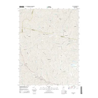
2014 Map of Wallace
USGS Topo · Published 2014About this map
Wallace and Brown serve as the primary crossroads in this rural landscape near the intersection of Harrison and Wetzel counties. The area is defined by a dense network of winding creek valleys, including Bingamon Creek and the Little Tenmile Creek drainage, which dictate the placement of early settlements and family cemeteries. Significant for local historians, the map identifies numerous small burial grounds such as the Scritchfield Cemetery and the Independent Order of Oddfellows Cemetery near Brown.
Find a feature on this map
126 named features on this map. Tap any name to fly to it.
Don’t see what you’re looking for? This feature index may not catch every label — zoom into the map to look around manually.
Map Details
Editions of this 2014 Wallace Map
This is the sole edition of this map. No revisions or reprints were ever made.
Other maps of this area

1902 · Clarksburg
USGS Topo · 1:62,500

1903 · Littleton
USGS Topo · 1:62,500

1905 · Mannington
USGS Topo · 1:62,500

1905 · Centerpoint
USGS Topo · 1:62,500

1905 · Littleton
USGS Topo · 1:62,500

1910 · Clarksburg
USGS Topo · 1:62,500

1923 · Mannington
USGS Topo · 1:62,500

1923 · Clarksburg
USGS Topo · 1:62,500

1924 · Centerpoint
USGS Topo · 1:62,500

1924 · Littleton
USGS Topo · 1:62,500