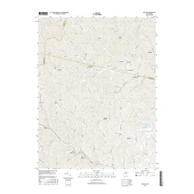
2016 Map of Wallace
USGS Topo · Published 2016About this map
Wallace and the surrounding drainages of Big Elk Creek characterize this 2016 survey along the borders of Wetzel, Marion, and Harrison Counties. The landscape is defined by an intricate network of hollows and runs, where small communities like Brown, Dola, and Joetown are connected by narrow county routes that follow the valley floors. Genealogists will find a high concentration of family-named burial sites throughout these hills, including the Independent Order of Oddfellows Cem near Brown, the Elizabeth Mason Memorial Park in the north, and numerous smaller plots like the Hildreth Cem and Scritchfield Cem. The geography is shaped by watercourses such as Wolfpit Run and Crabapple Run, illustrating how settlement patterns in this part of West Virginia remained tied to the winding topography and the relative isolation of places like Margaret and Alliance.
Find a feature on this map
121 named features on this map. Tap any name to fly to it.
Don’t see what you’re looking for? This feature index may not catch every label — zoom into the map to look around manually.
Map Details
Editions of this 2016 Wallace Map
This is the sole edition of this map. No revisions or reprints were ever made.
Other maps of this area

1902 · Clarksburg
USGS Topo · 1:62,500

1903 · Littleton
USGS Topo · 1:62,500

1905 · Mannington
USGS Topo · 1:62,500

1905 · Centerpoint
USGS Topo · 1:62,500

1905 · Littleton
USGS Topo · 1:62,500

1910 · Clarksburg
USGS Topo · 1:62,500

1923 · Mannington
USGS Topo · 1:62,500

1923 · Clarksburg
USGS Topo · 1:62,500

1924 · Centerpoint
USGS Topo · 1:62,500

1924 · Littleton
USGS Topo · 1:62,500