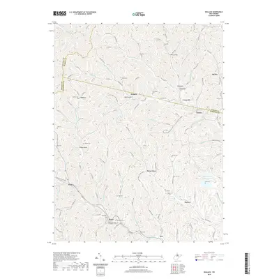
2019 Map of Wallace
USGS Topo · Published 2019About this map
Bingamon Cr and Little Tenmile Creek carve through the landscape of the Harrison and Marion county borders, framing a network of small West Virginia settlements. Small communities like Wallace, Margaret, and Joetown are interconnected by winding routes such as Co Rte 3, highlighting a region defined by its creek valleys and narrow ridges. The area is dense with family and community landmarks, including the Independent Order of Oddfellows Cem and Elizabeth Mason Memorial Park. Local industrial history is marked by the presence of the Mine 95 Water Supply Reservoir near Jimtown, while numerous smaller burial grounds like Wetzel Cem and Scritchfield Cem are scattered across the uplands. The drainage patterns of Glade Fork and Little Elk Creek illustrate the challenging terrain that shaped local development through the late 20th and early 21st centuries.
Find a feature on this map
121 named features on this map. Tap any name to fly to it.
Don’t see what you’re looking for? This feature index may not catch every label — zoom into the map to look around manually.
Map Details
Editions of this 2019 Wallace Map
This is the sole edition of this map. No revisions or reprints were ever made.
Other maps of this area

1902 · Clarksburg
USGS Topo · 1:62,500

1903 · Littleton
USGS Topo · 1:62,500

1905 · Mannington
USGS Topo · 1:62,500

1905 · Centerpoint
USGS Topo · 1:62,500

1905 · Littleton
USGS Topo · 1:62,500

1910 · Clarksburg
USGS Topo · 1:62,500

1923 · Mannington
USGS Topo · 1:62,500

1923 · Clarksburg
USGS Topo · 1:62,500

1924 · Centerpoint
USGS Topo · 1:62,500

1924 · Littleton
USGS Topo · 1:62,500