2023 Map of Wallace
USGS Topo · Published 2023About this map
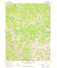
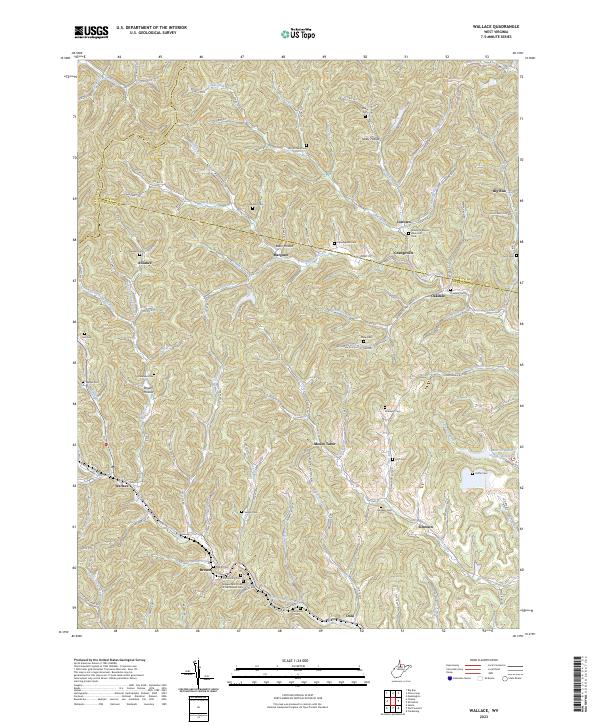
Wallace and the surrounding hollows of Harrison and Marion counties are defined by a complex network of stream valleys and family cemeteries. The landscape is carved by Little Tenmile Creek and Bingamon Creek, where small settlements like Brown, Dola, and Grangeville follow the winding lowlands. This survey provides a modern view of a region deeply rooted in genealogy, marked by numerous burial grounds such as the Independent Order of Oddfellows Cem, Rittenhouse Cem, and Scritchfield Cem. The distribution of these sites across terrain features like Wolfpit Hollow and Baker Hollow illustrates the historical pattern of family-centered settlement in north-central West Virginia. The presence of Elizabeth Mason Memorial Park near Joetown and various community nodes like Jimtown and Oakdale highlights the enduring nature of these rural Appalachian crossroads.
Find a feature on this map
106 named features on this map. Tap any name to fly to it.
Don’t see what you’re looking for? This feature index may not catch every label — zoom into the map to look around manually.
Map Details
Editions of this 2023 Wallace Map
This is the sole edition of this map. No revisions or reprints were ever made.