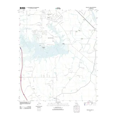
2012 Map of Wallace Lake
USGS Topo · Published 2012About this map
Wallace Lake dominates this landscape south of Shreveport, where the expanding residential developments of Ellerbe Woods, Wildoak, and Shadow Pine Estates meet the low-lying wetlands of the Red River basin. The area reflects a transition from rural homesteads and early river landings, such as De Broeck Landing and Palmer Landing, to a modern suburban fringe. The hydrological network is dense, with Bayou Pierre and Chico Bayou snaking through the eastern terrain toward the riverside settlements of Robson, Naylor, and Gayles.
Find a feature on this map
112 named features on this map. Tap any name to fly to it.
Don’t see what you’re looking for? This feature index may not catch every label — zoom into the map to look around manually.
Map Details
Editions of this 2012 Wallace Lake Map
This is the sole edition of this map. No revisions or reprints were ever made.
Other maps of this area

1938 · Arnsberg
USGS Topo · 1:31,680

1941 · Forbing
USGS Topo · 1:31,680

1945 · Grand Cane
USGS Topo · 1:62,500

1945 · Greenwood
USGS Topo · 1:62,500

1945 · Mansfield
USGS Topo · 1:62,500

1947 · Mansfield
USGS Topo · 1:62,500

1948 · Caspiana
USGS Topo · 1:62,500

1955 · Shreveport
USGS Topo · 1:250,000

1955 · Shreveport East
USGS Topo · 1:24,000

1955 · Caspiana
USGS Topo · 1:62,500