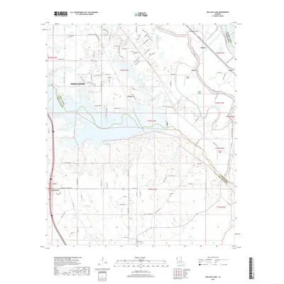
2018 Map of Wallace Lake
USGS Topo · Published 2018About this map
Wallace Lake and the meandering course of Bayou Pierre anchor this southern periphery of Shreveport, where the suburban expansion of Caddo Parish meets the rural stretches of De Soto and Bossier Parishes. The landscape is defined by its complex hydrology, with Chico Bayou and Gandy Bayou threading through low-lying areas, while higher ground supports small settlements like Stonewall and Norton. The transition from industrial transport to recreation is evident, as modern road networks like Southern Trail Pkwy and Overton Brooks Rd contrast with the older rural routes. For local historians, the presence of Springfield Cem and Antioch Cem provides a grounded connection to the area's early residents. Aviation heritage is also represented by Naylor Airport and Ellerbe Field, marking the area's role in local transportation and commerce near the Red River.
Find a feature on this map
106 named features on this map. Tap any name to fly to it.
Don’t see what you’re looking for? This feature index may not catch every label — zoom into the map to look around manually.
Map Details
Editions of this 2018 Wallace Lake Map
This is the sole edition of this map. No revisions or reprints were ever made.
Other maps of this area

1938 · Arnsberg
USGS Topo · 1:31,680

1941 · Forbing
USGS Topo · 1:31,680

1945 · Grand Cane
USGS Topo · 1:62,500

1945 · Greenwood
USGS Topo · 1:62,500

1945 · Mansfield
USGS Topo · 1:62,500

1947 · Mansfield
USGS Topo · 1:62,500

1948 · Caspiana
USGS Topo · 1:62,500

1955 · Shreveport
USGS Topo · 1:250,000

1955 · Shreveport East
USGS Topo · 1:24,000

1955 · Caspiana
USGS Topo · 1:62,500