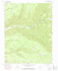
1963 Map of Wallace Ranch
USGS Topo · Published 1990About this map
The Dolores River carves a deep path through the high plateaus of Montezuma County, anchoring a landscape defined by seasonal ranching and water management. On the heights of Taylor Mesa and Haycamp Mesa, a network of small, isolated water bodies like Taylor Mesa Reservoir and Greenlee Reservoir reflects the critical importance of livestock watering in the San Juan National Forest. Movement across this terrain is marked by historical routes such as the High Line Driveway and Section House Driveway, which served as essential corridors for moving herds through the forest. Evidence of local habitation and land use is sparse but significant, centered on the Wallace Ranch and Circle K Ranch along the riverbanks, where the topography levels out briefly before rising again into steep gulches like Cushman Gulch and Priest Gulch.
Find a feature on this map
59 named features on this map. Tap any name to fly to it.
Don’t see what you’re looking for? This feature index may not catch every label — zoom into the map to look around manually.
Map Details
Editions of this 1963 Wallace Ranch Map
4 editions found

Other maps of this area

1895 · La Plata
USGS Topo · 1:62,500

1897 · La Plata
USGS Topo · 1:62,500

1897 · Rico
USGS Topo · 1:62,500

1898 · Rico
USGS Topo · 1:62,500

1899 · La Plata
USGS Topo · 1:62,500

1899 · Rico
USGS Topo · 1:62,500

1908 · La Plata
USGS Topo · 1:62,500

1956 · Cortez
USGS Topo · 1:250,000

1958 · Cortez
USGS Topo · 1:250,000

1959 · Cortez
USGS Topo · 1:250,000