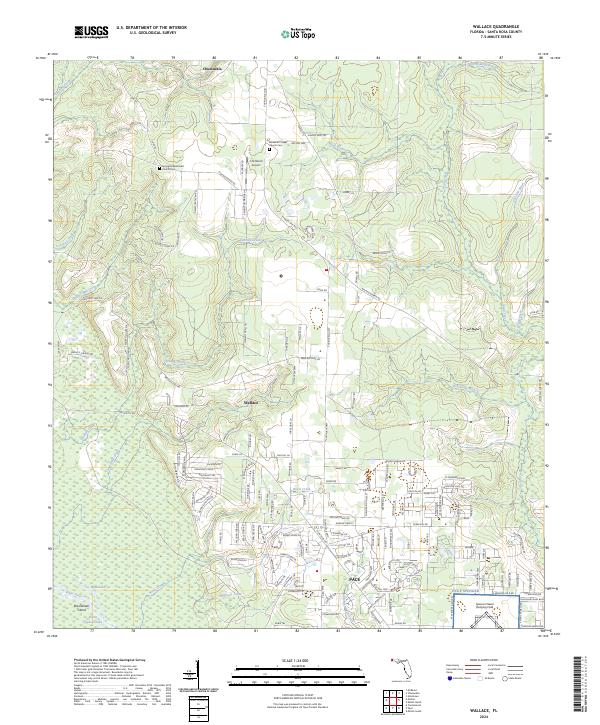
2024 Map of Wallace
USGS Topo · Published 2024About this map
The community of Wallace serves as a central point in this Santa Rosa County landscape, where the rural character of the northern Florida panhandle meets the encroaching development of Pace. The terrain is defined by a dense network of watercourses, including Tenmile Creek, Buffalo Mill Creek, and Hurricane Branch, which carve through the region toward the White River. In the northern reaches, the map documents the settlement of Chumuckla and essential community landmarks such as Springhill Methodist Church Cem and Elizabeth Chapel Church Cem, which offer significant value for genealogical research.
Find a feature on this map
167 named features on this map. Tap any name to fly to it.
Don’t see what you’re looking for? This feature index may not catch every label — zoom into the map to look around manually.
Map Details
Editions of this 2024 Wallace Map
This is the sole edition of this map. No revisions or reprints were ever made.
Other maps of this area

1920 · Milton
USGS Topo · 1:62,500

1921 · Muscogee
USGS Topo · 1:62,500

1941 · Muscogee
USGS Topo · 1:62,500

1941 · Milton
USGS Topo · 1:62,500

1941 · Century
USGS Topo · 1:62,500

1943 · Muscogee
USGS Topo · 1:62,500

1943 · Century
USGS Topo · 1:62,500

1943 · Milton
USGS Topo · 1:62,500

1943 · Jay
USGS Topo · 1:62,500
1944 · Floridatown
USGS Topo · 1:25,000