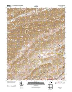
2013 Map of Wallace
USGS Topo · Published 2013About this map
The N Fork Holston River winds through the northern reaches of this Washington County landscape, where the historic crossing at Buffalo Ford and the church at Craigs Mill anchor a network of rural hollows and gaps. The terrain is defined by prominent ridges such as Big Jack Ridge and Big Ridge, which separate the various creek valleys. Numerous small settlements and named family locales are scattered throughout the region, including Burson Place, Benhams, and Haskell. To the south, the population centers of Wallace and Walnut Grove mark the transition toward more developed corridors, while the west features the distinctive Robinette Gap and Wooten Gap. This topographic survey provides a detailed look at the rural Appalachian infrastructure of the early 21st century, where narrow roads like Rich Valley Rd follow the natural contours of valleys such as Caney Valley.
Find a feature on this map
148 named features on this map. Tap any name to fly to it.
Don’t see what you’re looking for? This feature index may not catch every label — zoom into the map to look around manually.
Map Details
Editions of this 2013 Wallace Map
This is the sole edition of this map. No revisions or reprints were ever made.
Other maps of this area

1897 · Bristol
USGS Topo · 1:125,000

1902 · Bristol
USGS Topo · 1:125,000

1918 · Carterton
USGS Topo · 1:62,500

1920 · Coeburn
USGS Topo · 1:48,000

1934 · Wallace
USGS Topo · 1:24,000

1934 · Holston Valley
USGS Topo · 1:24,000

1934 · Brumley
USGS Topo · 1:24,000

1934 · Hansonville
USGS Topo · 1:24,000

1934 · Wyndale
USGS Topo · 1:24,000

1934 · Bristol
USGS Topo · 1:24,000