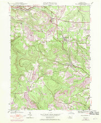
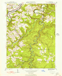
1945 Map of Wallaceton
USGS Topo · Published 1970About this map
Wallaceton sits at the heart of this Clearfield County survey, where the Penn Central rail lines weave through the valleys of Boggs and Decatur townships. The landscape is defined by its industrial and community infrastructure as it appeared during the post-war era, with subsequent 1969 revisions highlighting the growth of Strip Mine operations. Small settlements such as Bigler, Woodland, and Blue Ball West Decatur PO are connected by a network of rural roads that also link numerous local institutions. The mapping reveals a high density of rural education and worship sites, including the Eagle Eye Sch, New Castle Sch, and Salem Ch. Extensive drainage systems like Roaring Run and Little Laurel Run illustrate the complex hydrology of this coal-bearing region, which supported both timber and mining interests throughout the mid-20th century.
Find a feature on this map
33 named features on this map. Tap any name to fly to it.
Don’t see what you’re looking for? This feature index may not catch every label — zoom into the map to look around manually.
Map Details
Editions of this 1945 Wallaceton Map
4 editions found
Other maps of this area

1903 · Houtzdale
USGS Topo · 1:62,500

1905 · Houtzdale
USGS Topo · 1:62,500

1922 · Philipsburg
USGS Topo · 1:62,500

1929 · Karthaus
USGS Topo · 1:62,500

1929 · Clearfield
USGS Topo · 1:48,000

1932 · Clearfield
USGS Topo · 1:62,500

1932 · Karthaus
USGS Topo · 1:62,500

1939 · Philipsburg
USGS Topo · 1:62,500

1944 · Houtzdale
USGS Topo · 1:24,000
1944 · Glen Richey
USGS Topo · 1:24,000
Featured Places
- Bigler, Bradford Township
- Wallaceton, PA
- Decatur Township, PA
- Spring Valley, Boggs Township
- Morris Township, PA