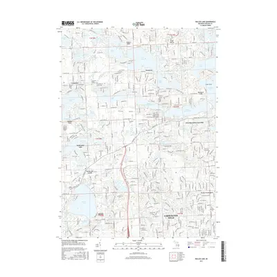
2017 Map of Walled Lake
USGS Topo · Published 2017About this map
The Huron River and its network of glacial lakes define this portion of Oakland County, where suburban development intermingles with several long-standing cemeteries and recreational water bodies. Modern residential street grids in Farmington Hills, Novi, and Walled Lake show the density of the 21st-century Detroit metropolitan area, yet the landscape preserves early landmarks such as the Commerce Village Burying Ground and Four Towns Cem. The survey illustrates the complex hydrology of the region, from the large expanse of Walled Lake and Wolverine Lake to smaller basins like Mercedes Lake and Scotch Lake. Notable for genealogists, the map identifies several smaller burial sites including the Hosier Family Cem and Richardson Cem, while drainage features like the Minnow Pond Drain and Hopes Creek trace the historical flow of water through these developing townships.
Find a feature on this map
108 named features on this map. Tap any name to fly to it.
Don’t see what you’re looking for? This feature index may not catch every label — zoom into the map to look around manually.
Map Details
Editions of this 2017 Walled Lake Map
This is the sole edition of this map. No revisions or reprints were ever made.
Other maps of this area

1902 · South Lyon
USGS Topo · 1:62,500

1904 · Ann Arbor
USGS Topo · 1:125,000

1905 · Wayne
USGS Topo · 1:62,500

1906 · South Lyon
USGS Topo · 1:62,500

1907 · Pontiac
USGS Topo · 1:62,500

1908 · Ann Arbor
USGS Topo · 1:125,000

1909 · Milford
USGS Topo · 1:62,500

1912 · Wayne
USGS Topo · 1:62,500

1936 · Wixom
USGS Topo · 1:31,680

1936 · Highland
USGS Topo · 1:31,680
Featured Places
- Farmington Hills, MI
- Waterford Township, MI
- Novi, MI
- West Bloomfield Township, MI
- Commerce Charter Township, MI