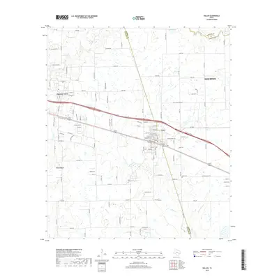
2019 Map of Waller
USGS Topo · Published 2019About this map
Waller sits at the intersection of rural heritage and suburban expansion, straddling the line between Waller County and Harris County. This landscape is defined by the headwaters of the regional drainage system, with Mound Creek, Snake Creek, and Ponds Creek carving paths through the terrain. The presence of Saint Marys Cemetery and Waller Cemetery provides a genealogical anchor for local families, while the northern reaches of Houston and the university community of Prairie View reflect the area's development along the primary transit corridors. The survey captures a network of family-named roads like Mayer Road and Joe Loggins Road that connect scattered farmsteads and agricultural plots. This map documents a transition in land use, where established rural roads meet newer residential developments, all centered around the water resources of Adams Lake and Little Mound Creek.
Find a feature on this map
108 named features on this map. Tap any name to fly to it.
Don’t see what you’re looking for? This feature index may not catch every label — zoom into the map to look around manually.
Map Details
Editions of this 2019 Waller Map
This is the sole edition of this map. No revisions or reprints were ever made.
Other maps of this area

1916 · Hockley
USGS Topo · 1:24,000

1916 · Swanson
USGS Topo · 1:24,000

1919 · Swanson
USGS Topo · 1:31,680

1920 · Hockley
USGS Topo · 1:31,680

1920 · Waller
USGS Topo · 1:31,680

1950 · Houston
USGS Topo · 1:250,000

1953 · Seguin
USGS Topo · 1:250,000

1954 · Beaumont
USGS Topo · 1:250,000

1954 · Austin
USGS Topo · 1:250,000

1955 · Brookshire
USGS Topo · 1:62,500