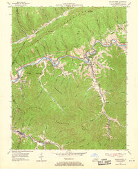
1954 Map of Wallins Creek
USGS Topo · Published 1969About this map
Pine Mountain dominates the northern skyline of this mid-century survey, creating a dramatic natural barrier for the Cumberland River valley below. The river’s path is closely shadowed by the Louisville and Nashville railroad, which served the numerous coal-town settlements and depots that line the corridor. Communities like Wallins Creek (Wallins Sta) and Coldiron appear at a time when the rail-and-river economy was central to life in Harlan County.
Find a feature on this map
73 named features on this map. Tap any name to fly to it.
Don’t see what you’re looking for? This feature index may not catch every label — zoom into the map to look around manually.
Map Details
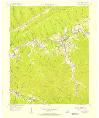
Editions of this 1954 Wallins Creek Map
2 editions found
Other maps of this area

1886 · Cumberland Gap
USGS Topo · 1:125,000

1887 · Jonesville
USGS Topo · 1:125,000

1888 · Cumberland Gap
USGS Topo · 1:125,000

1891 · Cumberland Gap
USGS Topo · 1:125,000

1891 · Jonesville
USGS Topo · 1:125,000

1903 · Harlan
USGS Topo · 1:48,000

1903 · Pineville
USGS Topo · 1:48,000

1903 · Middlesboro
USGS Topo · 1:48,000

1916 · Harlan
USGS Topo · 1:48,000

1919 · Harlan
USGS Topo · 1:62,500