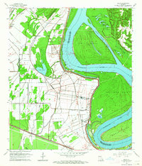
1963 Map of Walls
USGS Topo · Published 1964About this map
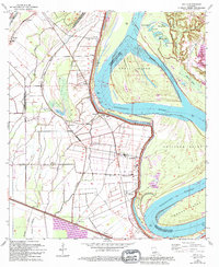
Profit Island and the meandering Mississippi River dominate this West Baton Rouge landscape, where the shifting river channel created intricate oxbows and landforms like Solitude Point. The low-lying terrain is protected by an extensive levee system, supporting a dense network of plantation-era settlements and agricultural tracts. Communities such as Smithfield, Chamberlin, and Walls are linked by the Texas and Pacific and Missouri Pacific railroads, reflecting a local economy tied to both the river and the rails. Numerous spiritual landmarks, including Zion Traveler Ch, Pilgrim Ch, and St Pauls Ch, alongside an ancient Indian Mound near Bueche, point to a long and layered history of habitation in the river bends of South Louisiana.
Find a feature on this map
54 named features on this map. Tap any name to fly to it.
Don’t see what you’re looking for? This feature index may not catch every label — zoom into the map to look around manually.
Map Details
Editions of this 1963 Walls Map
5 editions found
Other maps of this area

1906 · Bayou Sara
USGS Topo · 1:125,000

1908 · Baton Rouge
USGS Topo · 1:62,500

1939 · Zachary
USGS Topo · 1:62,500

1939 · Baton Rouge
USGS Topo · 1:62,500

1940 · Grosse Tete
USGS Topo · 1:62,500

1953 · Baton Rouge West
USGS Topo · 1:24,000

1953 · Lobdell
USGS Topo · 1:24,000

1953 · New Roads
USGS Topo · 1:24,000

1954 · Zachary
USGS Topo · 1:24,000

1954 · Port Hudson
USGS Topo · 1:24,000