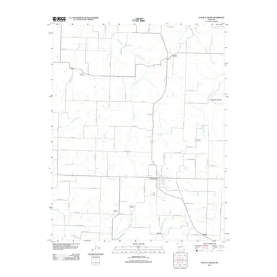
2011 Map of Walnut Grove
USGS Topo · Published 2011About this map
Walnut Grove and its surrounding rural network are defined by a grid of farm roads and winding creek branches in this 2011 topographic study. The landscape is dotted with several small settlements, including Eudora to the north and Phenix at the southern edge, reflecting the enduring agricultural character of Greene County. Waterways like Turkey Creek and King Branch cut through the terrain, providing natural landmarks that have guided local land boundaries for generations. For genealogists and local historians, the map is particularly valuable for its precise location of family and community burial grounds, such as Green Lawn Cemetery, Leeper Cemetery, and Lemmon Cemetery. Smaller hubs like Knox and Graydon Springs further illustrate the distribution of regional population centers. This contemporary survey preserves the placement of named roads and natural features, serving as a reliable reference for the area's modern-day layout.
Find a feature on this map
72 named features on this map. Tap any name to fly to it.
Don’t see what you’re looking for? This feature index may not catch every label — zoom into the map to look around manually.
Map Details
Editions of this 2011 Walnut Grove Map
This is the sole edition of this map. No revisions or reprints were ever made.
Other maps of this area

1884 · Springfield
USGS Topo · 1:125,000

1884 · Bolivar
USGS Topo · 1:125,000

1886 · Stockton
USGS Topo · 1:125,000

1886 · Greenfield
USGS Topo · 1:125,000

1886 · Springfield
USGS Topo · 1:125,000

1888 · Greenfield
USGS Topo · 1:125,000

1892 · Bolivar
USGS Topo · 1:125,000

1948 · Willard
USGS Topo · 1:24,000

1954 · Springfield
USGS Topo · 1:250,000

1955 · Dadeville
USGS Topo · 1:24,000