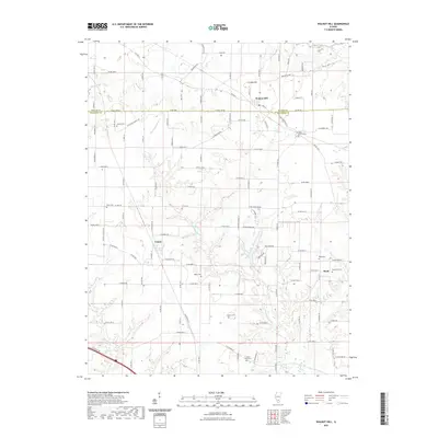
2021 Map of Walnut Hill
USGS Topo · Published 2021About this map
Walnut Hill sits at the junction of Marion and Jefferson Counties, serving as a focal point for this agrarian landscape in southern Illinois. The area is defined by the meandering course of the Big Muddy River and its tributaries, including Webster Creek and Raccoon Creek, which carve through the terrain near Creeds Hill. This survey highlights a network of rural settlements and small crossroad communities such as Cravat, Boyd, and Bundyville. Genealogists will find a wealth of site-specific data through numerous family and community burial grounds, including the Gilead Cemetery, Piskey Cemetery, and Gaston Cemetery. The map captures the persistent rural character of the region, where historical property divisions are still reflected in the grid of county roads like Oniontown Road and East Base Line Road.
Find a feature on this map
113 named features on this map. Tap any name to fly to it.
Don’t see what you’re looking for? This feature index may not catch every label — zoom into the map to look around manually.
Map Details
Editions of this 2021 Walnut Hill Map
This is the sole edition of this map. No revisions or reprints were ever made.
Other maps of this area

1914 · Centralia
USGS Topo · 1:62,500

1933 · Mount Vernon
USGS Topo · 1:48,000

1934 · Salem
USGS Topo · 1:62,500

1935 · Centralia
USGS Topo · 1:62,500

1938 · Salem
USGS Topo · 1:62,500

1940 · Mount Vernon
USGS Topo · 1:62,500

1943 · Ashley
USGS Topo · 1:62,500

1946 · Ashley
USGS Topo · 1:62,500

1958 · Belleville
USGS Topo · 1:250,000

1962 · Belleville
USGS Topo · 1:250,000