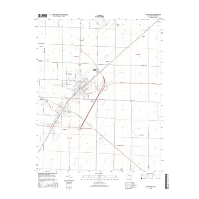
2014 Map of Walnut Ridge
USGS Topo · Published 2014About this map
Walnut Ridge and neighboring Hoxie anchor this Lawrence County landscape, where the confluence of major regional highways and a network of drainage ditches shapes the local geography. The map illustrates a developed transportation hub centered around the Walnut Ridge Regional Airport and the convergence of Us-67, Us-63, and Us-412. Beyond the urban centers, the terrain is defined by a complex system of waterways designed for agricultural management, including White Oak Slough, Marrow Bone Slough, and Little White Oak Ditch. Genealogists and local historians will find significant value in the numerous burial grounds documented across the township, such as Whittaker Cem, Adams Cem, and Austin Cem. The layout of streets and small settlements like Murta and Dicus reflects the area's ongoing importance as a crossroads in northeastern Arkansas, maintaining its character through a blend of aviation history and fertile alluvial plains.
Find a feature on this map
110 named features on this map. Tap any name to fly to it.
Don’t see what you’re looking for? This feature index may not catch every label — zoom into the map to look around manually.
Map Details
Editions of this 2014 Walnut Ridge Map
This is the sole edition of this map. No revisions or reprints were ever made.
Other maps of this area

1932 · Walnut Ridge
USGS Topo · 1:62,500

1934 · Powhatan
USGS Topo · 1:62,500

1935 · Powhatan
USGS Topo · 1:62,500

1935 · Sedgwick
USGS Topo · 1:62,500

1935 · Alicia
USGS Topo · 1:62,500

1935 · Walnut Ridge
USGS Topo · 1:62,500

1953 · Memphis
USGS Topo · 1:250,000

1956 · Memphis
USGS Topo · 1:250,000

1957 · Poplar Bluff
USGS Topo · 1:250,000

1959 · Poplar Bluff
USGS Topo · 1:250,000