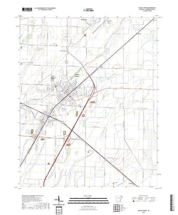
2024 Map of Walnut Ridge
USGS Topo · Published 2024About this map
Walnut Ridge and the adjacent town of Hoxie serve as the primary population centers in this portion of Lawrence County, Arkansas. The landscape is defined by a dense network of water management features, including White Oak Slough, Fry Ditch, and Little White Oak Ditch, which drain the low-lying terrain surrounding these communities. The Walnut Ridge Regional Airport occupies a significant footprint to the northeast, while College City sits just north of the central business district. For those researching local heritage, the map identifies numerous burial grounds such as Walnut Ridge Cem, Whittaker Cem, and the Westphal Cem. The administrative heart of the area is noted at the Lawrence County Courthouse, situated near the intersection of several major transit corridors that have shaped the development of this agricultural and transit hub.
Find a feature on this map
72 named features on this map. Tap any name to fly to it.
Don’t see what you’re looking for? This feature index may not catch every label — zoom into the map to look around manually.
Map Details
Editions of this 2024 Walnut Ridge Map
This is the sole edition of this map. No revisions or reprints were ever made.
Other maps of this area

1932 · Walnut Ridge
USGS Topo · 1:62,500

1934 · Powhatan
USGS Topo · 1:62,500

1935 · Powhatan
USGS Topo · 1:62,500

1935 · Sedgwick
USGS Topo · 1:62,500

1935 · Alicia
USGS Topo · 1:62,500

1935 · Walnut Ridge
USGS Topo · 1:62,500

1953 · Memphis
USGS Topo · 1:250,000

1956 · Memphis
USGS Topo · 1:250,000

1957 · Poplar Bluff
USGS Topo · 1:250,000

1959 · Poplar Bluff
USGS Topo · 1:250,000