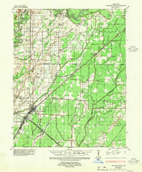
1935 Map of Walnut Ridge
USGS Topo · Published 1955About this map
The junction of the St Louis San Francisco RR and the Missouri Pacific RR serves as the economic anchor for Walnut Ridge and neighboring Hoxie in the mid-1930s. This survey, revised by the Mississippi River Commission, reveals a landscape defined by the winding course of the Black River to the north and the Cache River to the south. The proximity of Old Walnut Ridge and the Walnut Ridge Cem provides a tangible look at the settlement's early footprint. Rural life is well-documented through a dense network of country schools and churches, such as Skaggs Christian Ch and the combined Gum Stamp Ch & Sch. The map also captures the intricate drainage system of the Lowlands, with numerous sloughs like Nigger Head Slough and Float Slough alongside the developing Arkansas State Highway No 63 and other regional arteries.
Find a feature on this map
99 named features on this map. Tap any name to fly to it.
Don’t see what you’re looking for? This feature index may not catch every label — zoom into the map to look around manually.
Map Details
Editions of this 1935 Walnut Ridge Map
2 editions found
Other maps of this area

1932 · Walnut Ridge
USGS Topo · 1:62,500

1934 · Powhatan
USGS Topo · 1:62,500

1935 · Powhatan
USGS Topo · 1:62,500

1935 · Sedgwick
USGS Topo · 1:62,500

1935 · Alicia
USGS Topo · 1:62,500

1935 · Knobel
USGS Topo · 1:62,500

1935 · Reyno
USGS Topo · 1:62,500

1935 · Walnut Ridge
USGS Topo · 1:62,500

1939 · Jonesboro
USGS Topo · 1:62,500

1940 · Gainesville
USGS Topo · 1:62,500