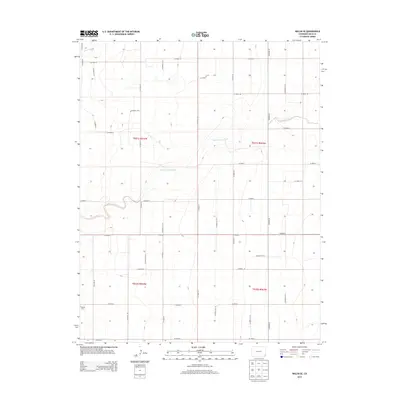
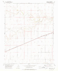
2013 Map of Walsh SE
USGS Topo · Published 2013About this map
Boston Cem sits in the southwestern reaches of this high plains landscape, a primary marker of the community history in this corner of Baca County. The terrain is defined by the ephemeral drainage systems of Sand Arroyo Creek and its smaller branch, Sand Arroyo Cr, which wind across the eastern and central sections, while Dry Creek cuts through the northwest corner. A rigorous grid of section lines and county roads, such as Co Road 44 and Co Road Aa, organizes the territory for agricultural and range use. This 2013 survey illustrates the enduring Public Land Survey System structure, with Township and Range divisions like t031s r044w providing the framework for land ownership and cattle ranching in a region where water sources and family landmarks remain the most significant geographical features.
Find a feature on this map
33 named features on this map. Tap any name to fly to it.
Don’t see what you’re looking for? This feature index may not catch every label — zoom into the map to look around manually.
Map Details
Editions of this 2013 Walsh SE Map
This is the sole edition of this map. No revisions or reprints were ever made.
Other maps of this area

1892 · Vilas
USGS Topo · 1:125,000

1955 · La Junta
USGS Topo · 1:250,000

1958 · La Junta
USGS Topo · 1:250,000

1968 · La Junta
USGS Topo · 1:250,000

1978 · Walsh SE
USGS Topo · 1:24,000
1978 · Midway
USGS Topo · 1:24,000
1978 · Walsh
USGS Topo · 1:24,000

1978 · Moore Draw NE
USGS Topo · 1:24,000
1978 · Vilas North
USGS Topo · 1:24,000
1978 · Bartlett
USGS Topo · 1:24,000