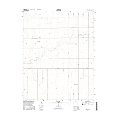
2016 Map of Walsh SE
USGS Topo · Published 2016About this map
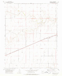
Boston Cem sits in the southwestern corner of this landscape, serving as a quiet reminder of early settlement patterns in Baca County. The terrain is defined by the winding course of Sand Arroyo Cr, which cuts diagonally across the central plains, joined in the northwest by Dry Cr. This 2016 survey illustrates the persistent agricultural grid that dictates the region's geography, with an extensive network of county roads like Co RD 39 and Co RD 45 framing the section lines. The map captures a high-plains environment where water drainage features and cemetery locations provide the primary historical landmarks for genealogists and local historians tracing the development of these remote townships.
Find a feature on this map
30 named features on this map. Tap any name to fly to it.
Don’t see what you’re looking for? This feature index may not catch every label — zoom into the map to look around manually.
Map Details
Editions of this 2016 Walsh SE Map
This is the sole edition of this map. No revisions or reprints were ever made.
Other maps of this area

1892 · Vilas
USGS Topo · 1:125,000

1955 · La Junta
USGS Topo · 1:250,000

1958 · La Junta
USGS Topo · 1:250,000

1968 · La Junta
USGS Topo · 1:250,000

1978 · Walsh SE
USGS Topo · 1:24,000
1978 · Midway
USGS Topo · 1:24,000
1978 · Walsh
USGS Topo · 1:24,000

1978 · Moore Draw NE
USGS Topo · 1:24,000
1978 · Vilas North
USGS Topo · 1:24,000
1978 · Bartlett
USGS Topo · 1:24,000