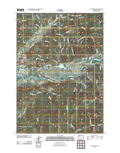
2011 Map of Walterville
USGS Topo · Published 2011About this map
The McKenzie River corridor dominates this 2011 survey, showing the intricate water management system centered around the community of Walterville. The map illustrates how the Walterville Canal diverts water from the river to the Walterville Reservoir and Walterville Dam, a critical piece of local infrastructure. To the west, the settlement of Cedar Flat marks the transition from the river valley to the surrounding forested hills. Genealogists and local historians will find the Camp Creek Cemetery north of the main settlement, along with numerous family-named roads like Mitchell Ln and Ermi Bee Rd that hint at the area's rural development. The landscape is deeply etched by a network of tributaries, including Camp Creek, Rock Creek, and Hills Creek, which descend from the higher elevations to feed the river valley's fertile bottomlands.
Find a feature on this map
81 named features on this map. Tap any name to fly to it.
Don’t see what you’re looking for? This feature index may not catch every label — zoom into the map to look around manually.
Map Details
Editions of this 2011 Walterville Map
This is the sole edition of this map. No revisions or reprints were ever made.
Other maps of this area
1935 · Lowell
USGS Topo · 1:96,000
1942 · Lowell
USGS Topo · 1:125,000
1950 · Marcola
USGS Topo · 1:62,500
1951 · Leaburg
USGS Topo · 1:62,500
1952 · Marcola
USGS Topo · 1:62,500

1953 · Salem
USGS Topo · 1:250,000

1954 · Salem
USGS Topo · 1:250,000
1955 · Hardesty Mtn
USGS Topo · 1:62,500
1955 · Lowell
USGS Topo · 1:62,500

1958 · Roseburg
USGS Topo · 1:250,000