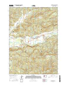
2017 Map of Walterville
USGS Topo · Published 2017About this map
The McKenzie River flows through this portion of Lane County, defining a landscape of riparian lowlands and rising timbered ridges. The unincorporated community of Walterville serves as a central hub, where the Walterville Canal diverts water to the Walterville Reservoir, a system highlighting the region's historical reliance on river management. To the west, the residential area of Cedar Flat occupies the level ground between the river and the steeper terrain of Camp Creek Ridge.
Find a feature on this map
74 named features on this map. Tap any name to fly to it.
Don’t see what you’re looking for? This feature index may not catch every label — zoom into the map to look around manually.
Map Details
Editions of this 2017 Walterville Map
This is the sole edition of this map. No revisions or reprints were ever made.
Other maps of this area

1935 · Lowell
USGS Topo · 1:96,000

1942 · Lowell
USGS Topo · 1:125,000

1950 · Marcola
USGS Topo · 1:62,500

1951 · Leaburg
USGS Topo · 1:62,500

1952 · Marcola
USGS Topo · 1:62,500

1953 · Salem
USGS Topo · 1:250,000

1954 · Salem
USGS Topo · 1:250,000

1955 · Hardesty Mtn
USGS Topo · 1:62,500

1955 · Lowell
USGS Topo · 1:62,500

1958 · Roseburg
USGS Topo · 1:250,000