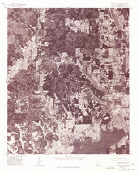
1976 Map of Walthall SE
USGS Topo · Published 1977About this map
Eupora serves as the primary hub of activity in this portion of Webster County, appearing here in a mid-1970s orthophotograph that reveals the intricate layout of the town's residential streets and commercial center. To the north, the small settlement of Walthall sits amidst a patchwork of agricultural clearings and dense woodlands, illustrating the rural character of the Mississippi interior during this era. The southern landscape is defined by the Big Black River, accompanied by a prominent Canal that suggests significant drainage and land management efforts to support local farming. Between these points, the hamlet of Grady anchors a network of rural roads, providing a clear view of the dispersed settlement patterns and the relationship between the small towns and the surrounding timberland and creek bottoms.
Find a feature on this map
5 named features on this map. Tap any name to fly to it.
Don’t see what you’re looking for? This feature index may not catch every label — zoom into the map to look around manually.
Map Details
Editions of this 1976 Walthall SE Map
This is the sole edition of this map. No revisions or reprints were ever made.
Other maps of this area

1953 · Walthall
USGS Topo · 1:62,500

1953 · West Point
USGS Topo · 1:250,000

1958 · West Point
USGS Topo · 1:250,000

1963 · West Point
USGS Topo · 1:250,000

1966 · Stewart
USGS Topo · 1:24,000

1966 · Tomnolen
USGS Topo · 1:24,000

1968 · Weir
USGS Topo · 1:62,500

1972 · Sapa
USGS Topo · 1:24,000

1972 · Hohenlinden
USGS Topo · 1:24,000
1972 · Reform
USGS Topo · 1:24,000