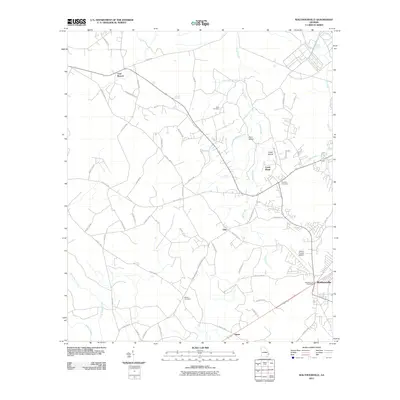
2011 Map of Walthourville
USGS Topo · Published 2011About this map
Walthourville and its surrounding communities in Liberty County define this portion of the Georgia coastal plain. The settlement pattern is largely rural, with established neighborhoods clustered near the Walthourville Post Office and along the transportation corridor extending toward Almar. Local history is preserved in small family and community burial grounds, such as Wells Cemetery, Popples Cemetery, and Barrett Cemetery, which sit among a complex network of county roads including Rye Patch Rd and Elim Church Rd.
Find a feature on this map
58 named features on this map. Tap any name to fly to it.
Don’t see what you’re looking for? This feature index may not catch every label — zoom into the map to look around manually.
Map Details
Editions of this 2011 Walthourville Map
This is the sole edition of this map. No revisions or reprints were ever made.
Other maps of this area

1918 · Jesup
USGS Topo · 1:62,500

1918 · Hinesville
USGS Topo · 1:62,500

1920 · Glennville
USGS Topo · 1:62,500

1943 · Ludowici
USGS Topo · 1:62,500

1943 · Jesup
USGS Topo · 1:62,500

1944 · Glennville
USGS Topo · 1:62,500

1944 · Hinesville
USGS Topo · 1:62,500

1946 · Brunswick
USGS Topo · 1:250,000

1948 · Brunswick
USGS Topo · 1:250,000

1950 · Glennville
USGS Topo · 1:62,500