Loading...
Loading map...2024 Map of Walthourville
USGS Topo · Published 2024About this map
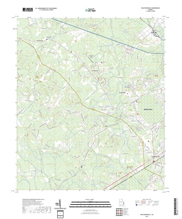
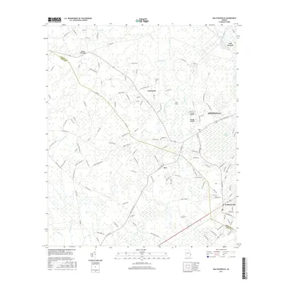
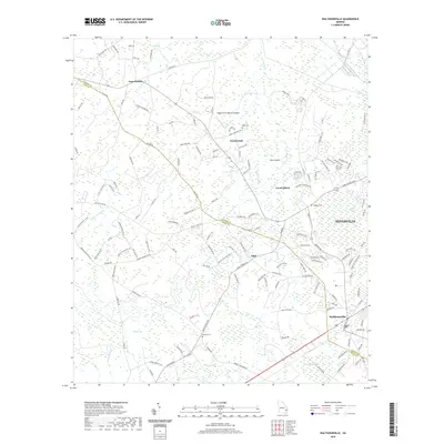
The coastal plain of Liberty County unfolds on this map, showing the southward expansion of Hinesville toward the junction at Walthourville. The landscape is a complex network of wetlands and low-lying features, including Brewert Bay and Milkhouse Bay, which are characteristic of this region's hydrography. The northern portion of the sheet is dominated by the sprawling military reservation of Fort Stewart, which significantly shapes local development and land use.
Find a feature on this map
153 named features on this map. Tap any name to fly to it.
Don’t see what you’re looking for? This feature index may not catch every label — zoom into the map to look around manually.
Map Details
Date Portrayed2024
Date Published2024
PublisherU.S. Geological Survey
Map TypeTopographic
Scale1:24,000
Physical Dimensions24 x 29 inches
Editions of this 2024 Walthourville Map
This is the sole edition of this map. No revisions or reprints were ever made.
Historical Maps of Hinesville Through Time
6 maps found
Featured Locations
Source Details
SourceU.S. Geological Survey
CopyrightPublic Domain